
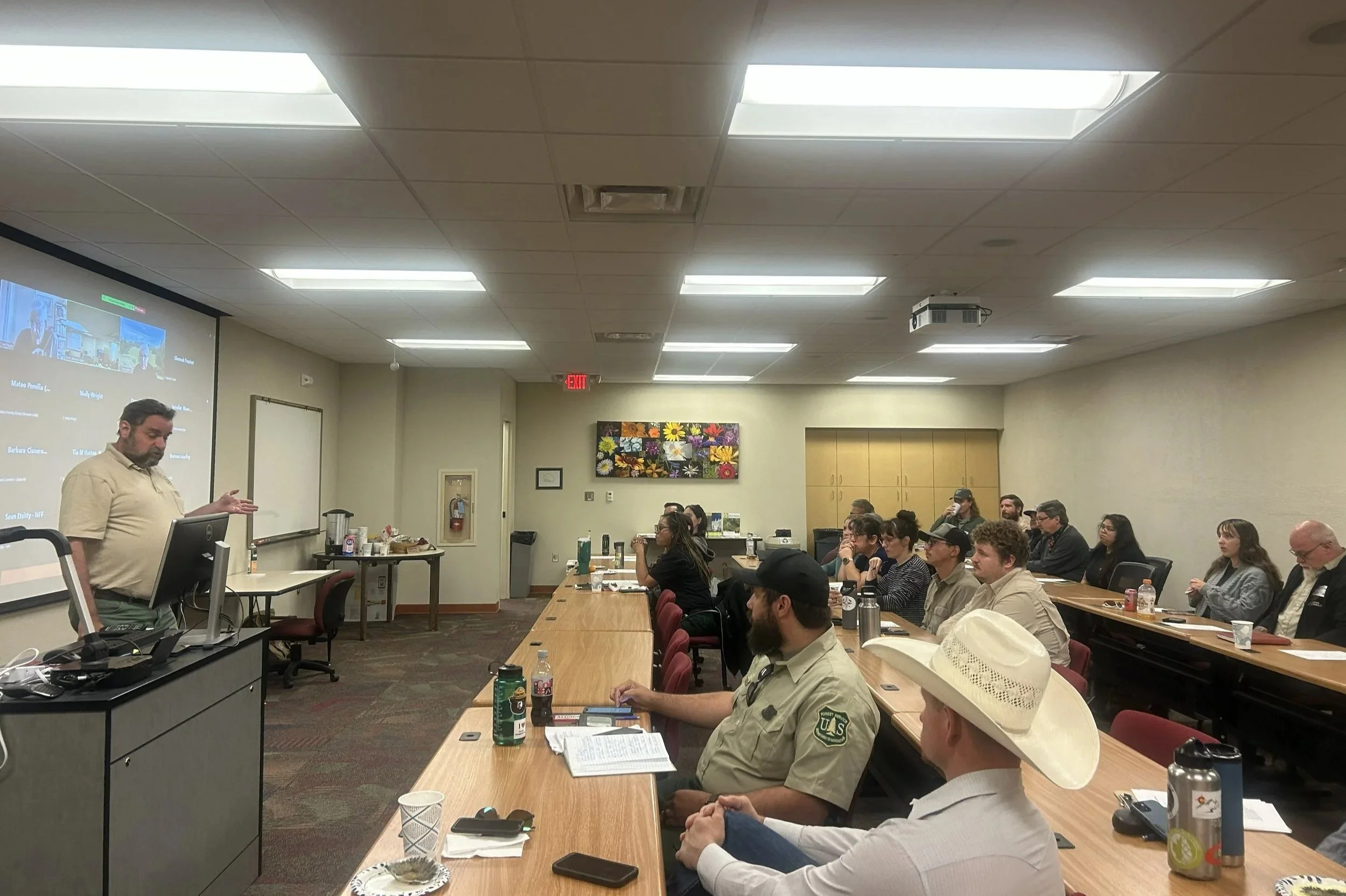
For the past 20 years, Zuni Mountains Collaborative (ZMC) partners and community members have come together each spring to catch up, share information and resources, and learn about what’s happening in the Zuni Mountains landscape. In late May, attendees gathered at New Mexico State University’s Grants campus for the 2026 ZMC Spring Meeting. In addition to networking and presentations, participants shared a meal from the Junkyard on 66, which we recommend checking out if you live in or are passing through Grants.
This year’s meeting was attended by about 50 individuals (30 in-person and 20 online) and featured presentations from the Cibola National Forest, Rocky Mountain Research Station, NM Forestry Division, and Chizh for Cheii. Presentations and detailed meeting notes are included below.
In addition, the gathering included breakout sessions on storytelling, participatory mapping, and future projects. Notes from these sessions are available below.
Jay Turner, Cibola NF Natural Resources & Planning Staff Officer, talks about the US Forest Service’s ongoing reorganization
Meeting Agenda and Notes

Click to view the meeting agenda

Click to view meeting highlights and full-length notes
Presentations and Resources
US Forest Service Updates
U.S. Forest Service - Mt. Taylor Ranger District updates.
Information was presented by Jay Turner, Natural Resources & Planning Staff Officer; Jason Eakins, Timber Management; Geraldine Antonio, Fire and Fuels Management; and Isaac Martinez, Rangeland Management Specialist. For more information, contact Jay at james.turner1@usda.gov
Rocky Mountain Research Station: forest treatments and Mexican Spotted Owl
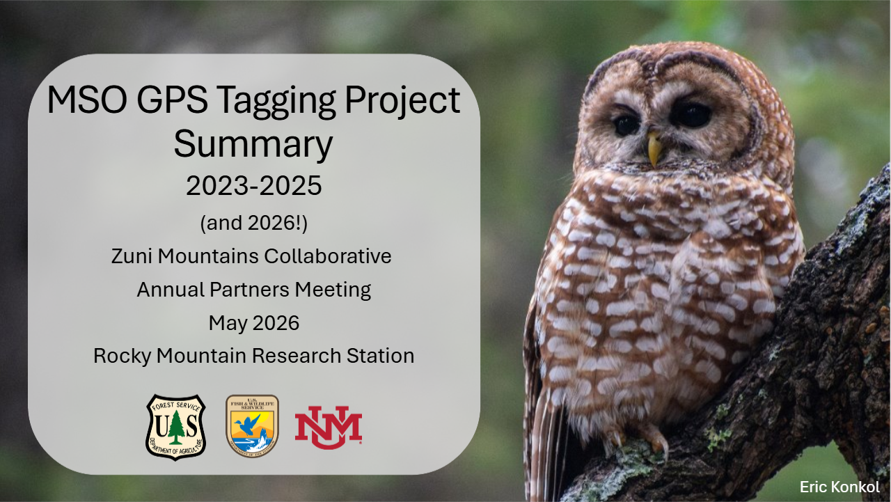
Rocky Mountain Research Station: Mexican Spotted Owl research and monitoring
Information presented by Paige Handley, Wildlife Biologist with the US Forest Service. Paige may be contacted at Paige.Handley@usda.gov
New Mexico Forestry Division: past, current and upcoming work

Map of the greater Zuni Mountains Landscape where the Bernalillo District of NM Forestry Division works. Additional information about this presentation may be found in the meeting notes.
Information presented by Lawrence Crane, District Forester. Lawrence may be contacted at lawrence.crane@emnrd.nm.gov
Chizh for Cheii: providing for our community
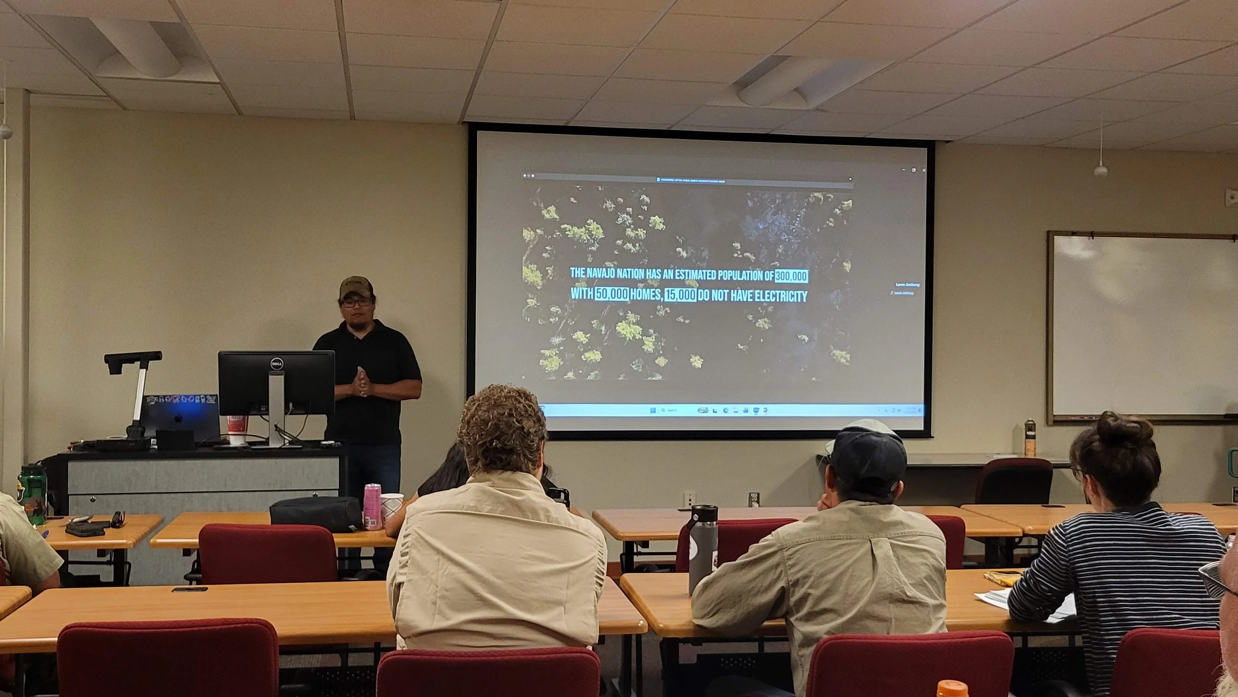
Loren Anthony, founder of Chizh for Cheii, presented on the group’s forming, mission, and work. While he did not have a slide deck which can be shared, a summary of his presentation may be found in the meeting notes.
Loren may be contacted at chizhforcheii@gmail.com
Collaborative Governance Survey
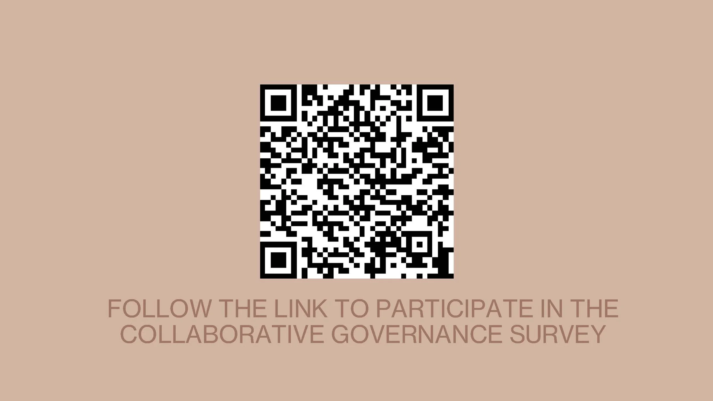
Attendees had the opportunity to participate in a collaborative governance survey being administered by the Ecological Restoration Institute. We invite you to fill out the survey by following the QR code or using this link. The results of this survey will help ZMC facilitators improve the effectiveness of the Collaborative.
Breakout sessions
Future Projects Brainstorm
The US Forest Service anticipates having funds available to focus on non-forest thinning activities within the CFLRP boundary in the next several years. This prompted a brainstorming exercise to envision what projects and programs members of the Collaborative would like to see advanced by the end of the CFLRP grant cycle.
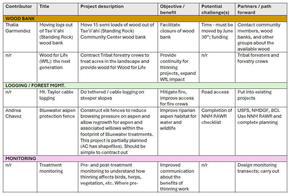
Summary table of future project ideas shared by participants. Click on the image to view more.
Participatory Mapping
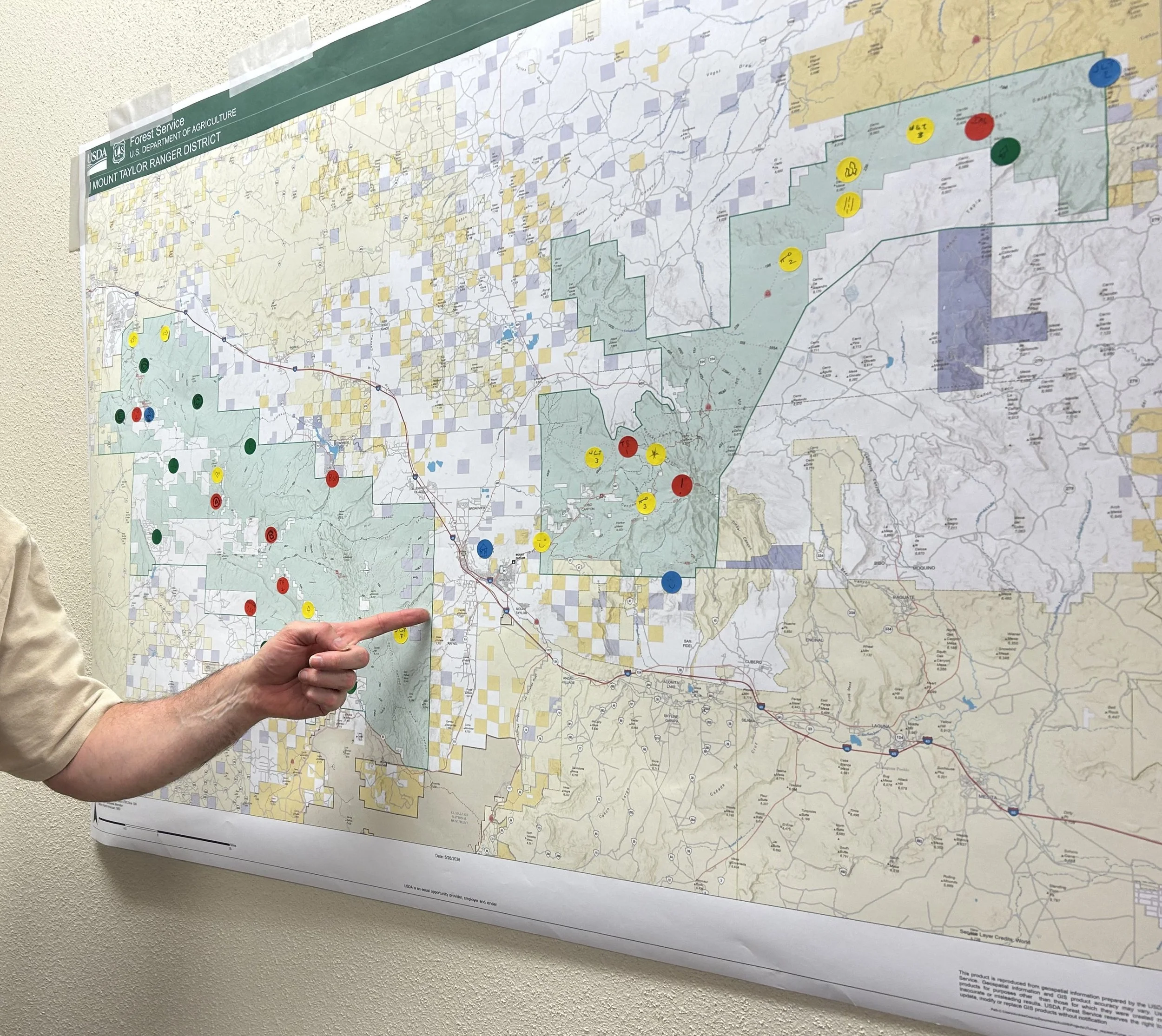
Participants placed stickers on a physical map during the meeting to indicate where they were working on the landscape.
Participatory mapping is a structured, collaborative process where members of a community represent, define or otherwise share spatial knowledge to inform planning and management. It offers a tool for participants to directly express their interests, perceptions, and experiences with regards to specific places and geographic landmarks, and for those interests to be collectively visualized. Our goal with the participatory mapping activity represented in the StoryMap below was to make places in the Zuni Mountains and surrounding area more visible and recognizable, as a way of deepening our conversations about this landscape.
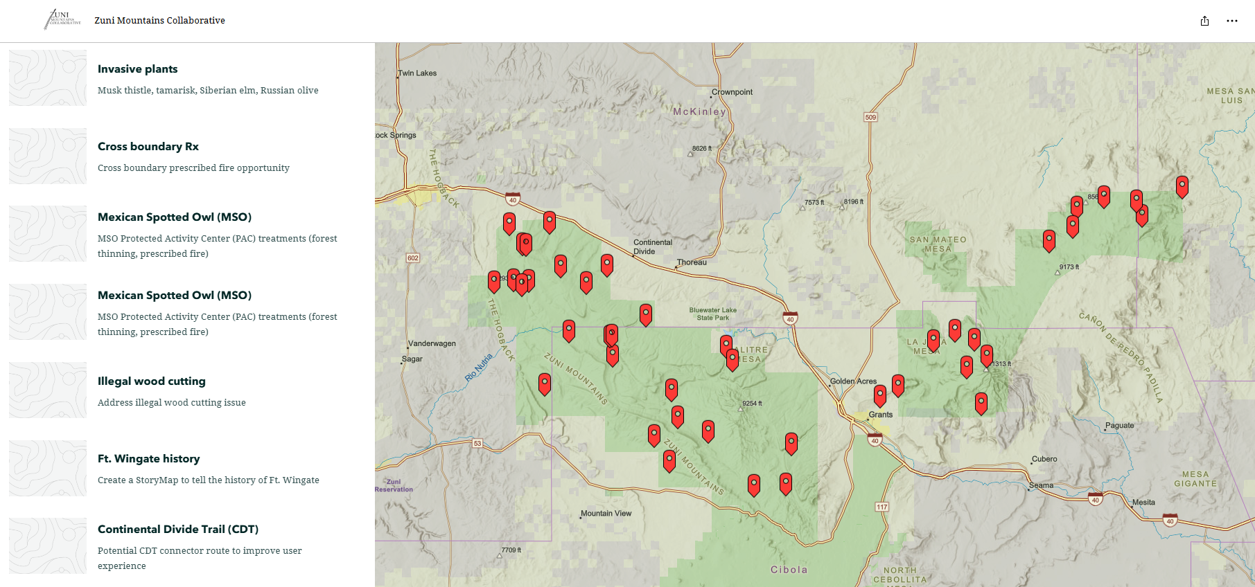
Interactive map of projects on the landscape shared by participants. Click on the image to view the StoryMap.