
Aristotle is credited with saying “the things we have to learn before we can do them, we learn by doing them.” Such is the challenge of land stewardship, that in order to learn how to better care for the forests and grasslands we have to jump into managing them and then refine our actions as we go along.
In the feedback loop of ecological monitoring and adaptive management, making improvements to any land stewardship approach requires monitoring that provides a comprehensive picture of the condition of the resources we are trying to protect. Tracking how conditions are changing allows us the space and knowledge to hone our methods and to learn from past efforts.
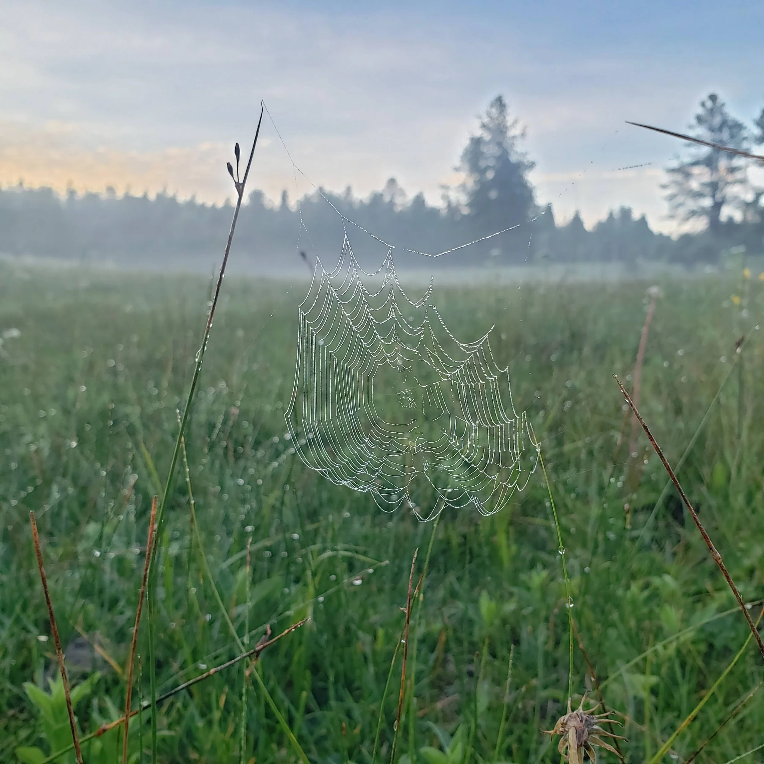
A dew-covered spider web sits just at the edge of an aspen stand one foggy morning
This is just what the Collaborative struck out to do in the autumn of 2022. U.S. Forest Service and Forest Stewards Guild staff spent several weeks in August through September establishing baseline data for aspen patches near Oso Ridge which are slated for stand improvement in 2023. In October through November, the Forest Stewards Guild and other Collaborative members held a series of virtual meetings looking at monitoring efforts over the past 10 years. Finally, in late November, Zuni Mountain partners participated in a field training day to learn about and dial in our water monitoring efforts.
Establishing baseline conditions: Aspen stands
At the south end of the Mt. Taylor Ranger District, snaking along Forest Road 50, Monighan Canyon sits above 8,000’ elevation. This area is characterized by narrow drainages, open meadows, wet mixed conifer transitioning into high elevation spruce and fir forest, and interspersed stands of decadent quaking aspen.

Through a mixture of ecosystem disturbances, including fire exclusion, adjacent ponderosa pine, blue spruce, and Douglas fir have begun to encroach on these aging aspen stands. In recognition of the ecosystem services as well as biological diversity that this unique deciduous forest type confers, the US Forest Service has laid out a plan to thin the surrounding conifer forest and take steps to encourage the regeneration of young aspen clones.
In order to be able to look back and evaluate the efficacy of these aspen restoration efforts once they are complete, the Forest needs quantitative data describing the pre-treatment condition of the area. Guild staff, a tree marking crew hired by the Guild and supervised by the Forest Service, and the Cibola National Forest silviculturist spent five weeks amongst the aspen establishing this pre-treatment dataset by identifying the prevalence of different tree and understory species as well as measuring tree diameter, height, disease and other metrics of tree health. The data collection method is replicable so that years from now, monitoring will reveal the effects of treatments. This contrast will allow land managers to determine whether the treatment was effective in reducing conifer encroachment and bolstering aspen health and abundance.
Collaborative monitoring priorities: Water
An all-partners meeting in summer 2022 revealed that a major concern for many members of the Zuni Mountains Collaborative is water:
quality,
quantity,
location,
protection,
riparian flora, and
accessibility to both humans and species of interest.

RiverSource, the Guild, and attendees of the field training day review how to take water quality measurements along Tampico Draw
To address these concerns and set the Collaborative up for the next decade of success, the Forest Stewards Guild and project collaborator RiverSource hosted several virtual meetings with partners from the US Forest Service, NM Game and Fish, US Fish and Wildlife Service, Zuni Pueblo Conservation Department, Navajo Forestry Department, NM Forestry Division, Bat Conservation International, Native Plant Society of NM, Great Old Broads for Wilderness, Cottonwood Gulch Expeditions, and private landowners. Attendees discussed challenges and accomplishments with ecological monitoring through the first 10 years of the Zuni Mountains CFLRP, identified lessons learned, highlighted water management needs in the present moment, and laid out a roadmap for what kind of monitoring should be prioritized in the future.
Part of planning for and prioritizing future monitoring is a commitment to continual learning and refinement of our shared methodology. The Guild and RiverSource organized and hosted a field training day on November 21st to evaluate water monitoring techniques that have been implemented over the past decade and to refine these techniques moving forward. The training, which took place in the critical Zuni Bluehead Sucker habitat of Tampico Draw, also provided Collaborative partners an opportunity to determine what data will be needed to effectively monitor water quality and quantity and should be included in the CFLRP multi-party monitoring plan.

Rich Schrader of RiverSource breaks through the November ice to get a depth measurement in one bedrock-lined pool along Tampico Draw.
Throughout this process, members of the Zuni Mountains Collaborative have remained committed to partnership, cooperation, and the exchange of knowledge and expertise. Different collaborators and stakeholders bring unique skills and wisdom to the landscape, all of which enrich and inform our approach to caring for the land and the people.